Detail and Topographic Surveys
Our detail survey teams are experts in their field producing quality mapping data, though the efficient use of robotic total stations, GPS rovers, 3D scanners and aerial drone mapping.
No matter the scale or intricacy of your project, our meticulous detail survey division is primed to deliver top-notch base mapping data. Quality data hinges on the bedrock of a precise survey control network, and our expertise spans the spectrum, from single-block surveys to expansive projects that necessitate the coordination of multiple teams across extensive distances. Our survey data is available in various formats, including compliance with the SA Department of Infrastructure and Transport standards, for which we proudly stand as a preferred supplier.
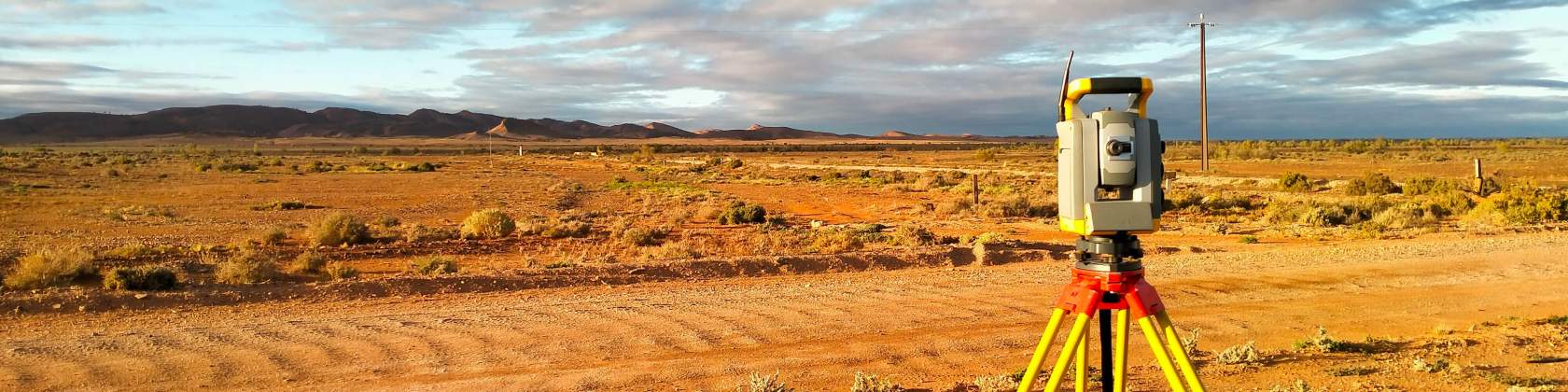
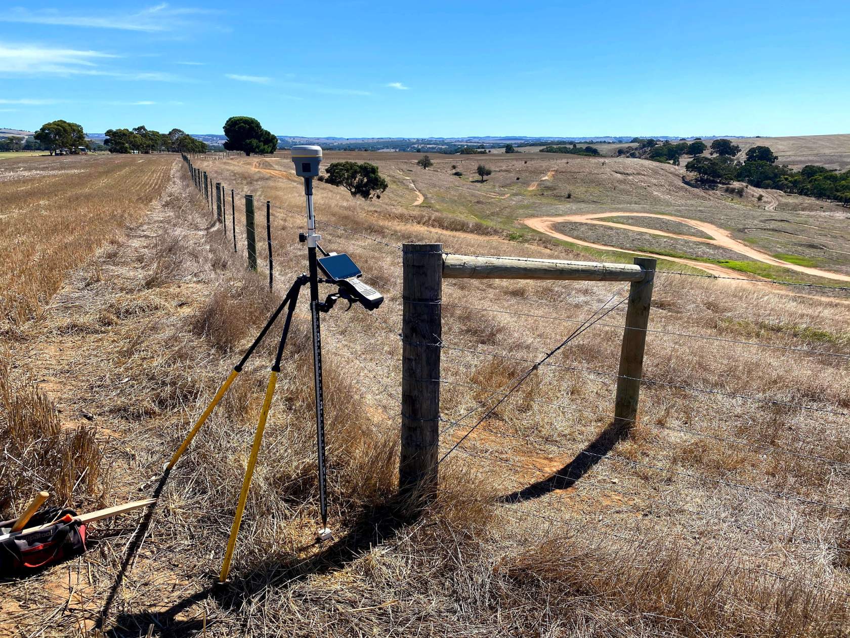
Survey control networks
Good survey data is dependent on the establishment of an accurate survey control network. Survey teams can establish small or large scale networks that span kilometres, established to a high level of accuracy suitable for construction to follow.
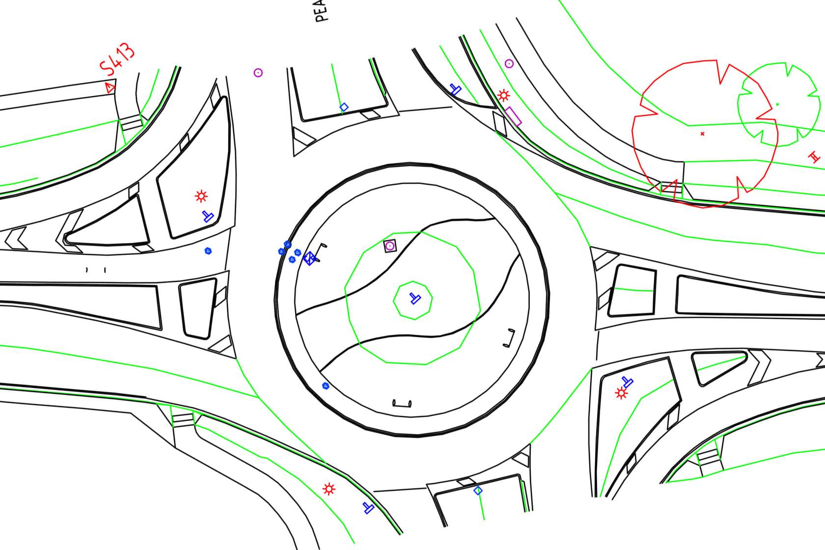
Roads
We can coordinate multiple teams, traffic control and service location to deliver quality road survey data. Surveys may be augmented with aerial drone or 3D scanning data.
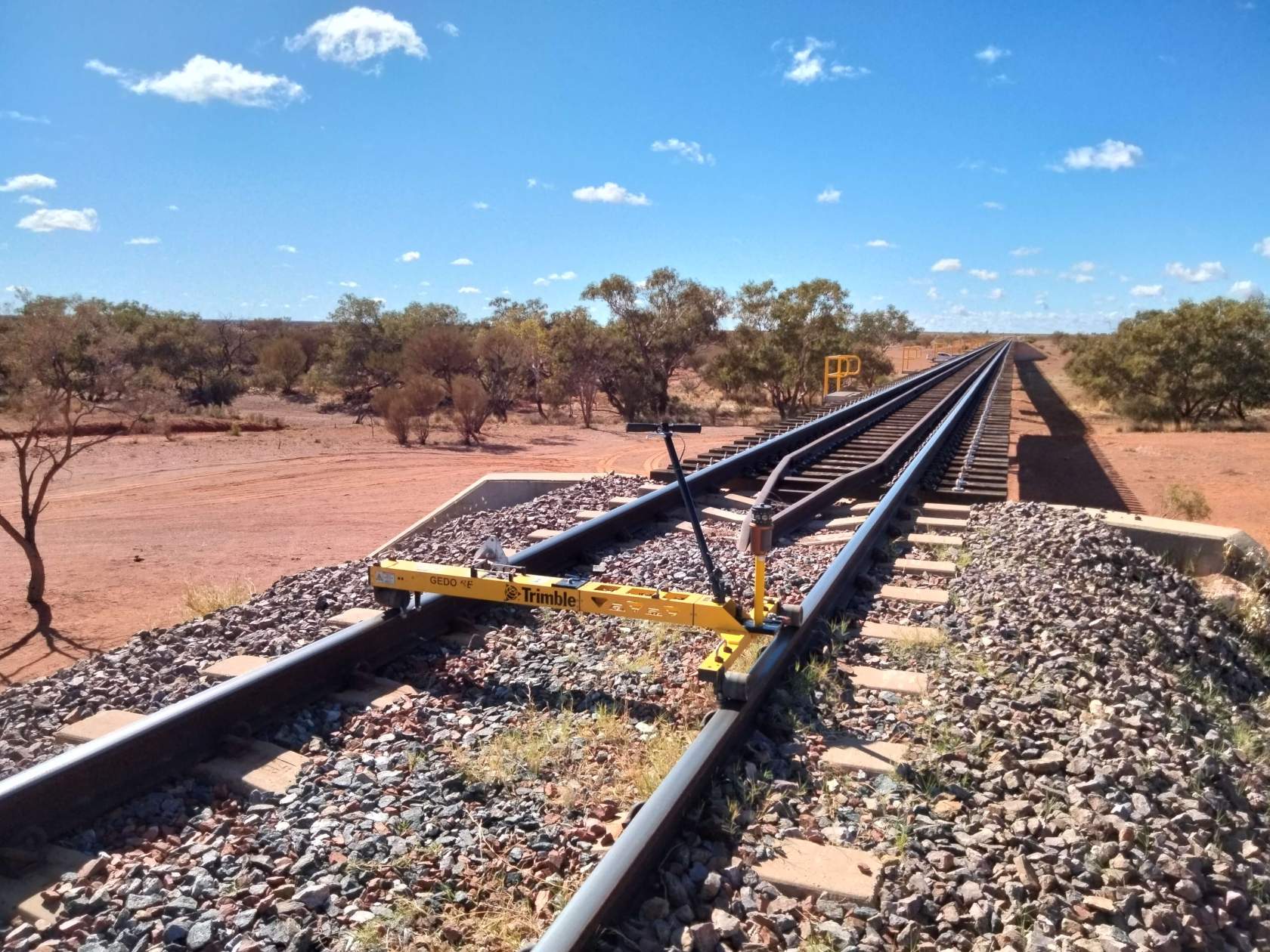
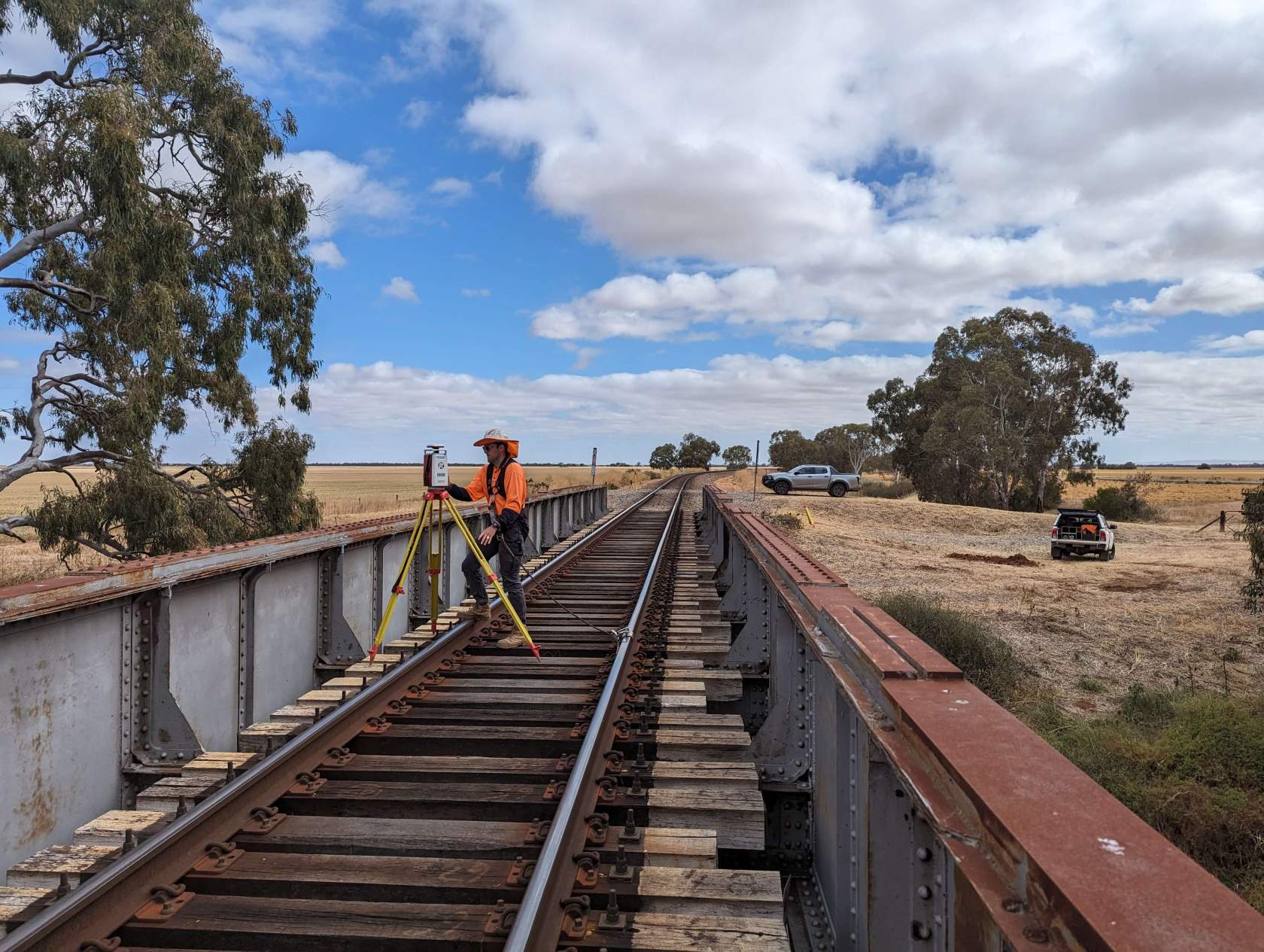
Rail
Expert rail teams understand the requirements for rail pickup and will work with track protectors and rail authorities producing quality rail and network infrastructure data.
Bridges
Our experienced teams can survey all the elements of a bridge. Where bridge elements are difficult to access, 3D scanners can be employed to pick up data remotely, or hydrographic soundings can be combined to capture bridge piling below the water line.
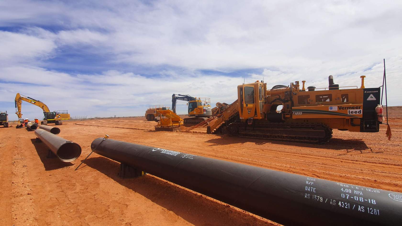
Pipelines
Pickup of a proposed pipeline route corridor is essential for planning. Surface models and crossing services location pickup can then be used to create longitudinal pipe route design plans.
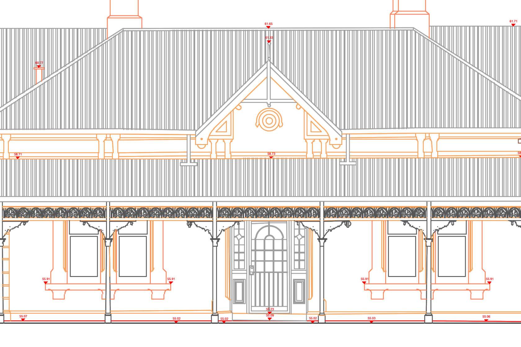
Buildings
Surveys of structures and multi-use areas can extend beyond a mere building footprint pickup. Surveys can identify internal walling, windows, doors, or any external elements such as façade and roofing features. 3D scanning and modelling can also be employed to produce detailed 3D CAD models for use with BIM, as well as elevations and streetscapes.
Allotments
Simple allotments can be quickly surveyed to identify site contours, fences, road infrastructure and services for building planning and the council approval process.
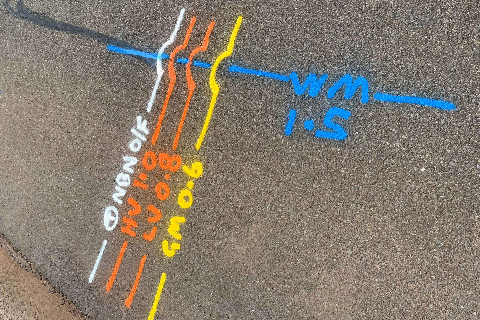
Underground services
Knowing the location of your project’s underground services can be an essential planning requirement – Engineering Surveys works with accredited service locators using a range of different techniques including Ground Penetrating Radar (GPR) to accurately define these locations. Service data models can be overlaid with other site data, or can even be identified visually on site using augmented reality systems such as the Trimble Site Vision.
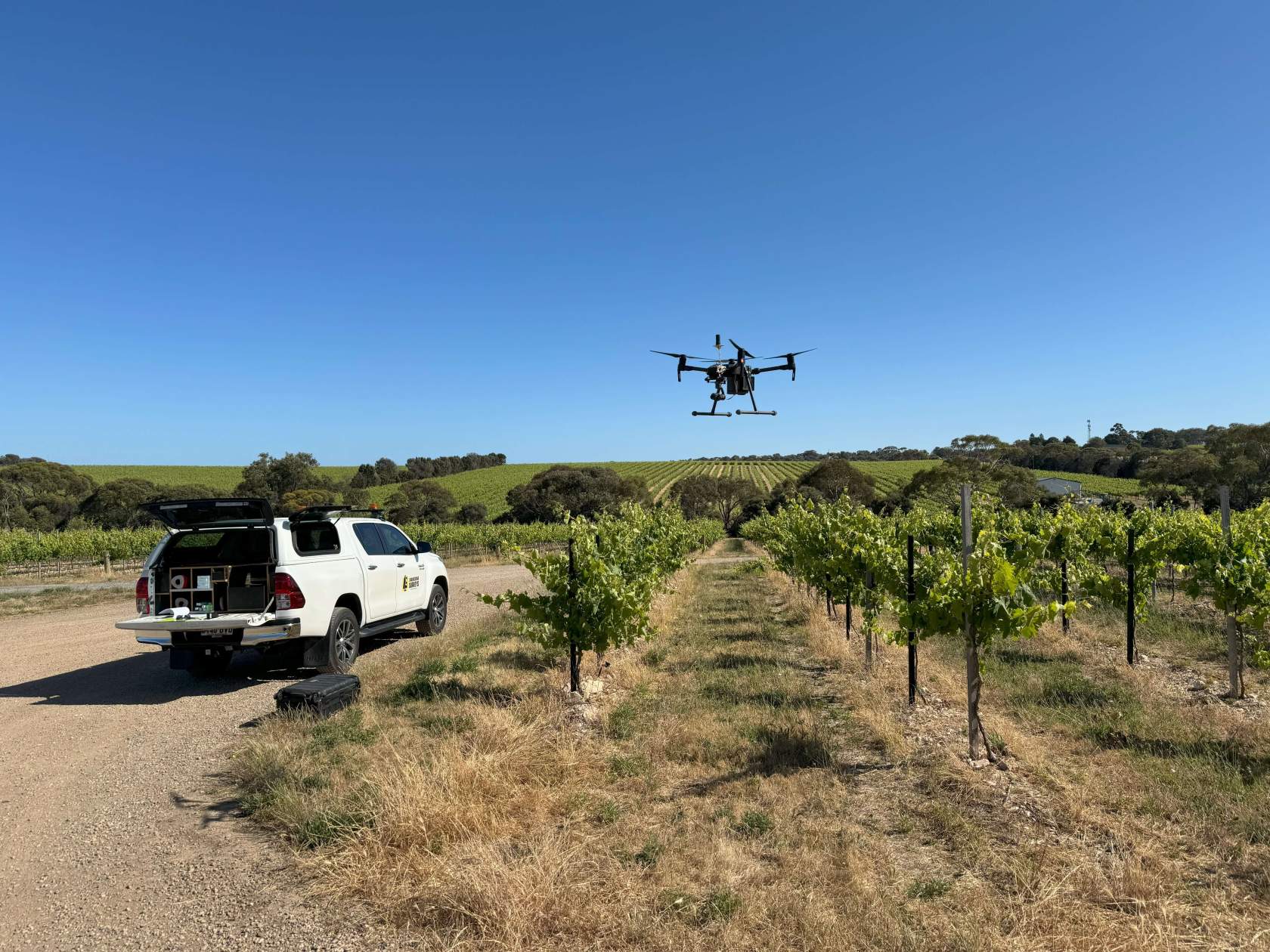
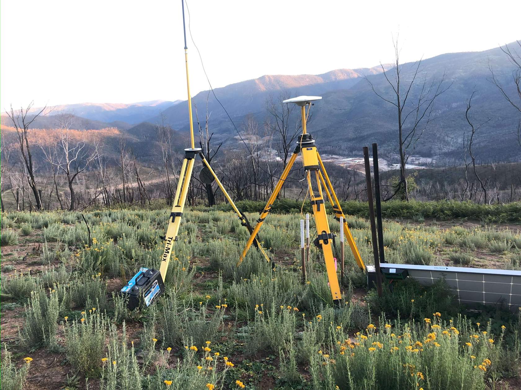
Rural land management
Large rural areas can be mapped quickly and efficiently with aerial drone mapping. Drone data can then be used to create detailed surface models and contours, as well as high quality orthophoto mosaic data. Traditional survey data can be overlaid and combined to create rich data sets to aid with many different land use requirements.
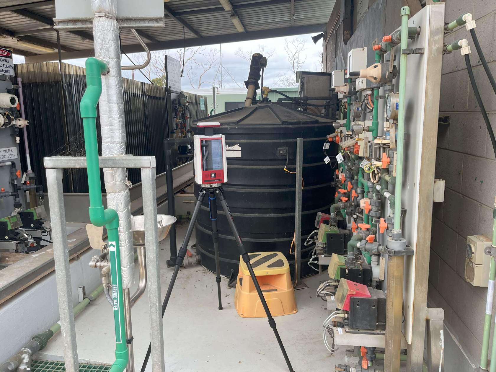
Other service infrastructure
Our expert teams can assist with all types of service infrastructure, from small to large scale networks we can employ a range of different technologies including internet GPS rover pickup for efficient long-range surveys, aerial drone mapping for large area capture, and 3D scanning and modelling to create detailed 3D models if required.

Value adding
Traditional survey pickup can be augmented with other survey offerings including aerial drone mapping to produce surface models and stunning orthophoto mosaics, and 3D scanning can be employed to produce detailed point cloud data, which can then be further modelled to produce 3D CAD data. All these offerings can be exported in a range of different formats for import into any software package.
Let our expert Detail Surveys Division managers assist you in finding the right engineering survey solution for your project. No matter the size or complexity we can deliver quality data sets and plans which will exceed your expectations. Partner with us today to experience the difference.