Streamlined CAD Drafting and Data Management Solutions
All Engineering Surveys’ surveyors are highly skilled with AutoCAD/BricsCAD and our civil engineering and survey package 12d Model. Our expertise extends beyond just drafting plans; our software 12d Model is a full Building Information Modelling (BIM) system with powerful attribute, meta data and visualization tools. Our surveyors routinely manage digital model data sets from multiple sources and formats making them highly skilled data managers.
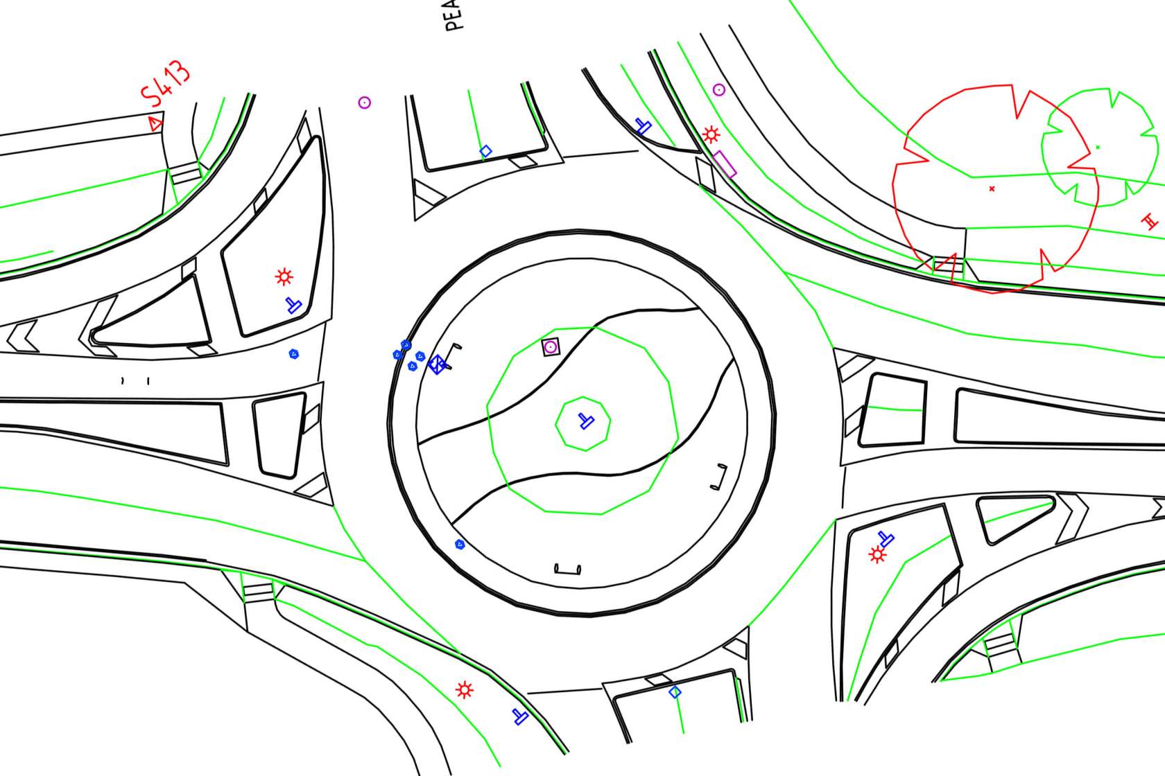
We can produce high quality plans in CAD for a number of applications including: boundary identification, lease plans, easements, strata title, amalgamation or land-division plans suitable for lodgement with the Land Titles Office (LTO).
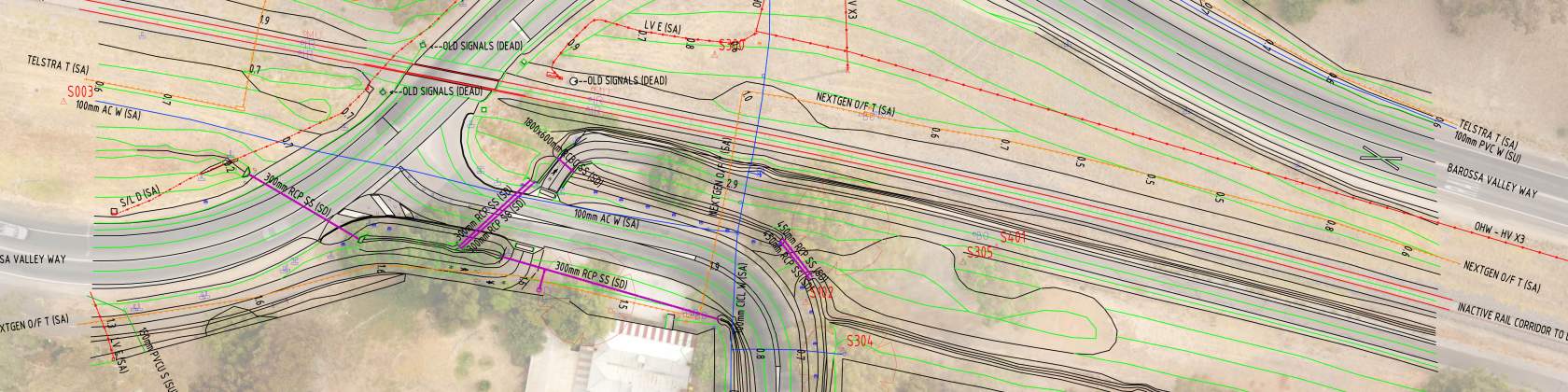
Our detail surveys are drafted to the highest quality and can be customized for any purpose, including the standards of SA Water and the Department of Infrastructure and Transport (DIT) with which we have considerable experience and expertise.
As-constructed plans can be produced for project QA conformance requirements whether the construction be for road, rail, underground services or any structural elements in building construction.
Digital Data Management
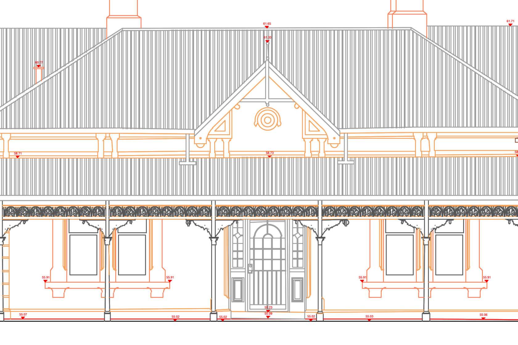
We can import and export 2D and 3D digital geometry from the majority of digital modelling software formats, or create CAD geometry from PDF or by digitising paper plans. We can overlay, combine or 3D model this data for a range of different purposes including clash detection, 2D or 3D presentation drawings or even animated fly-throughs.
CAD and Modelling Standards
Our survey drafters can produce plans and digital models to a number of different standards, including the Department of Infrastructure and Transport (DIT), SA Water, the Defence Spatial Data Management Plan (SDMP) or suitable for lodgement with the Land Titles Office (LTO). We can also customize our drawings to match any other required standard.

3D Modelling
Our CAD modelling teams can employ 3D modelling to dramatically reduce the size of large point cloud data sets produced by 3D scanning. 3D models can be easily shared, scaled, integrated with Building Information Management (BIM) software or used for conformance checks against design.
All Engineering Surveys delivers comprehensive CAD drafting and data management solutions tailored to meet the diverse needs of engineering projects. With a focus on precision, compliance, and efficiency, our team ensures seamless project execution from inception to completion.