Civil and Roadworks Surveys
Our team are experts in civil construction, including surveys for roads, bridges, civil and rail infrastructure, delivering accurate and timely surveys to give you confidence at all stages of the construction process.
We can partner with you to deliver timely survey support for your infrastructure projects. We have a broad base of construction expertise including extensive experience with major infrastructure for roads, bridges and rail.
Survey control networks
The integrity of a project’s spatial framework relies on the establishment of an accurate survey control network. Survey teams can establish small or large-scale networks that span kilometres, established to a high level of accuracy suitable for construction to follow.
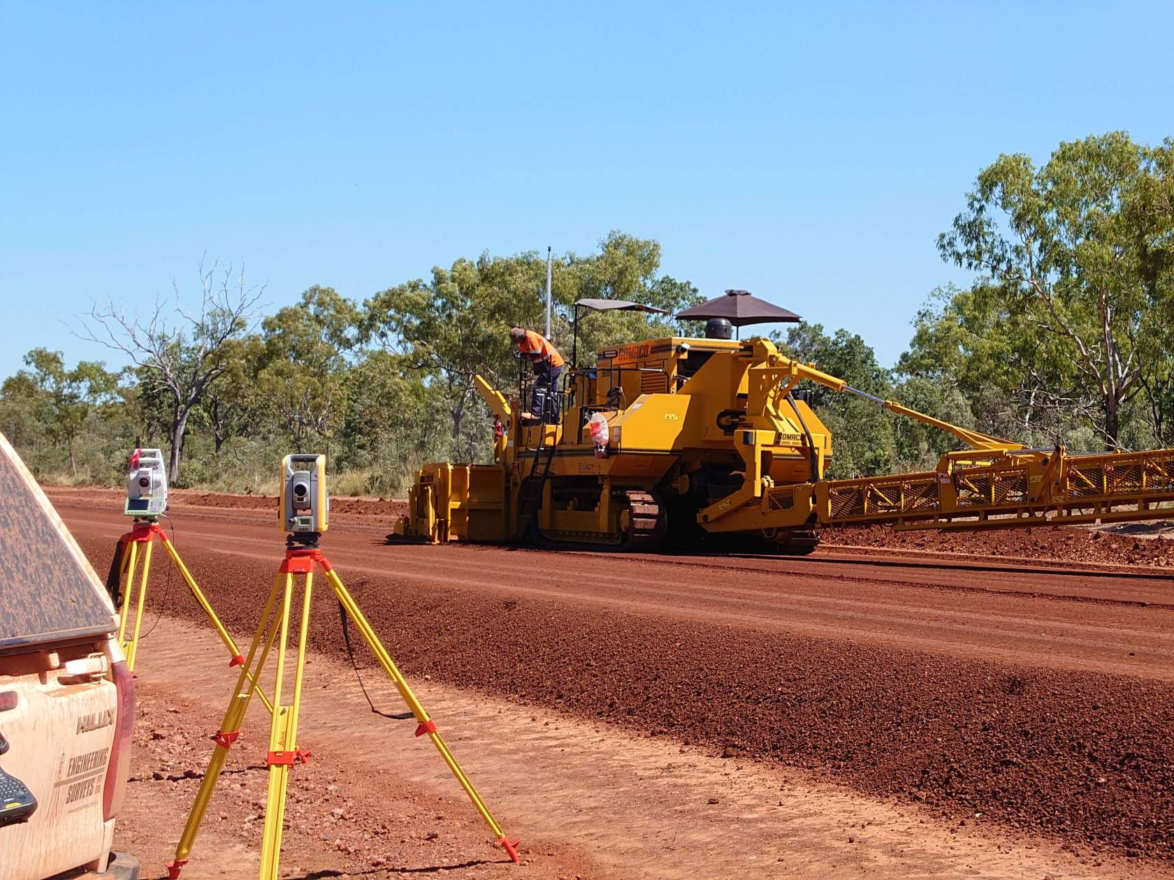
Support for machine control
Engineering Surveys can provide support for your machine control, including provision of any surface models, design points and linework for input into any machine control equipment on the market whether that be Trimble, Topcon or Leica systems. We can also provide a hardware support with our hire fleet of multiple Trimble GPS bases and rovers paired with the latest controllers.
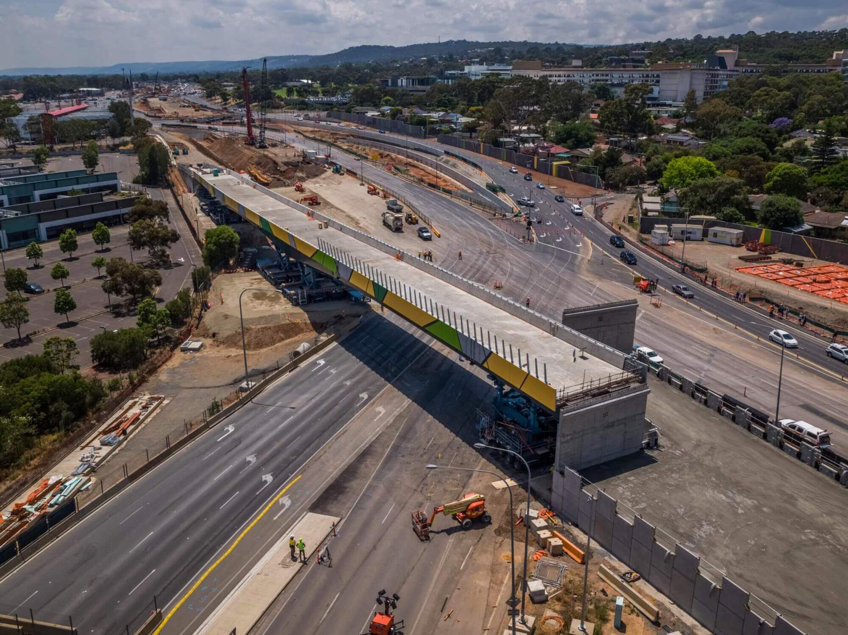
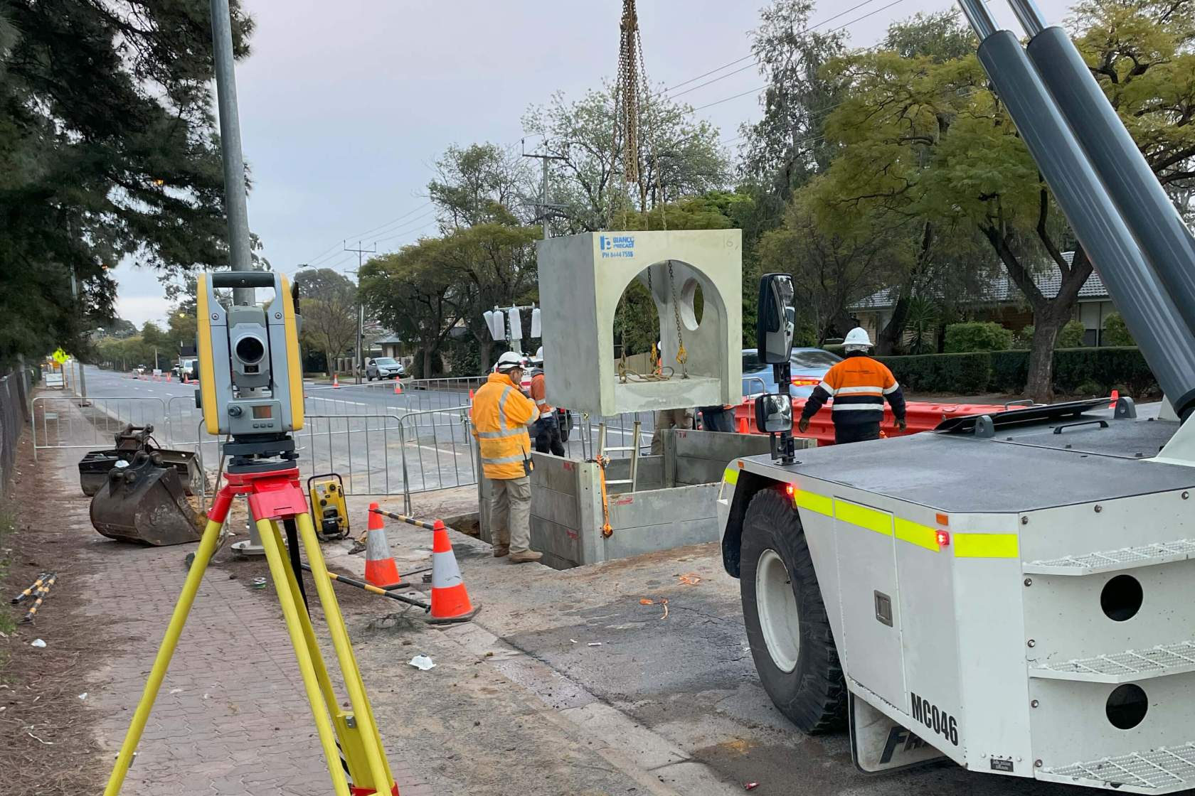
Road construction
Our civil teams are experts in all aspects of road construction, and can integrate with all stakeholders in providing full support for construction and any as-built reporting. Teams have worked on multiple Department of Infrastructure and Transport projects and have an in-depth knowledge of DIT standards for construction and as-built reports.

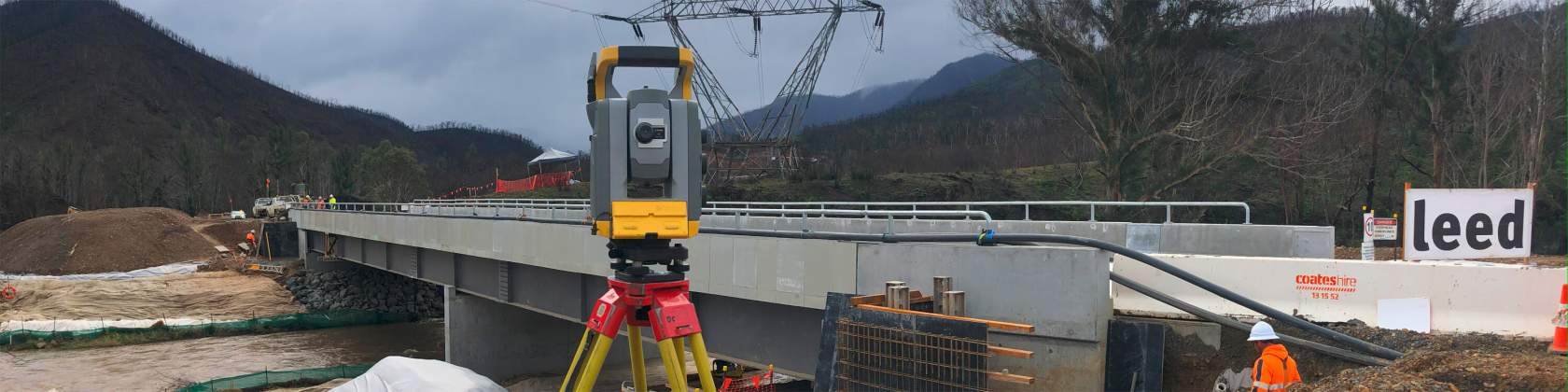
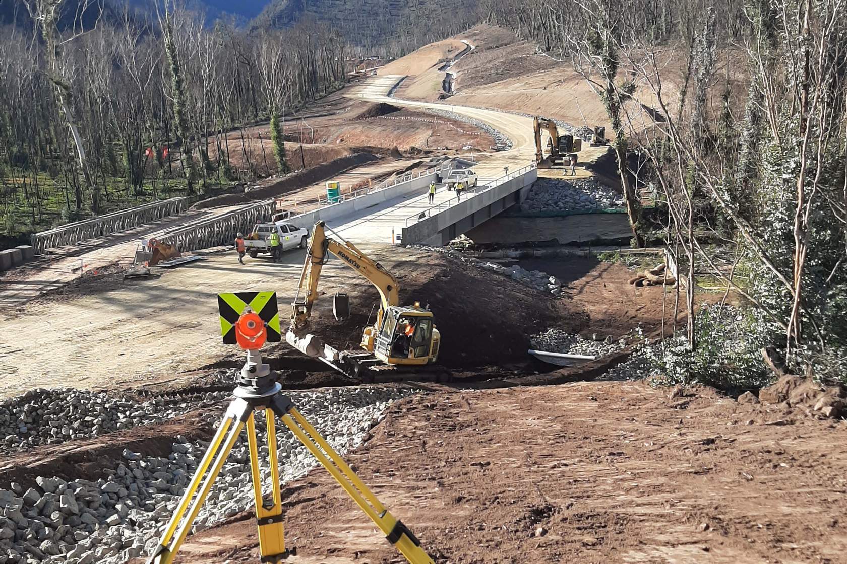
Bridge Construction
Our teams have extensive experience with many types of bridges and the accuracy required for all stages of the construction process.
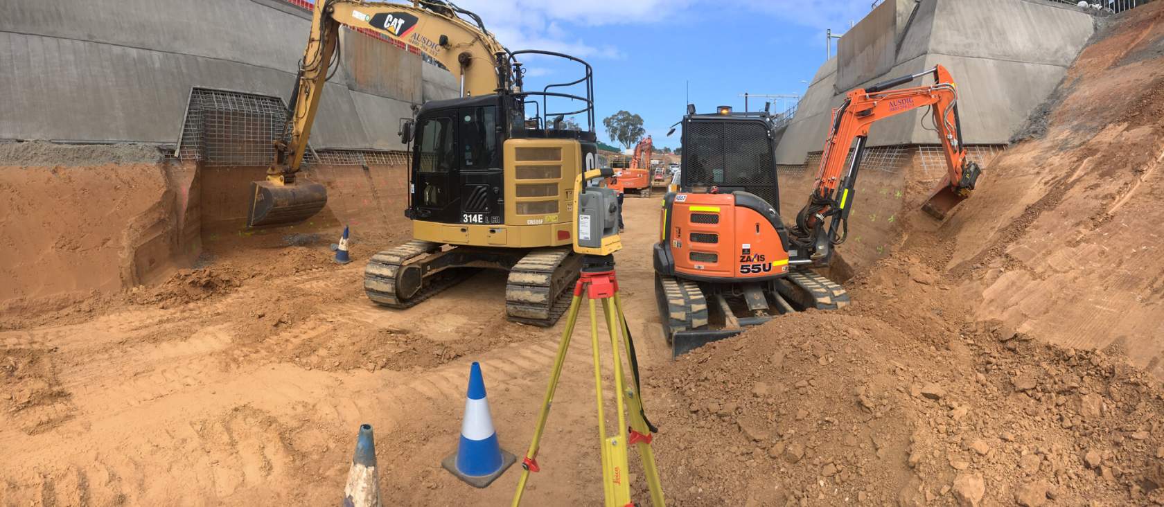
Bulk earthworks
Civil teams can provide a range of services for bulk earthworks including design surface modelling for machine control, GPS support and hire, aerial drone mapping or terrestrial 3D scanning for surface, volume and progress reporting.
Services infrastructure
Engineering Surveys is a certified locating organisation. We offer a range of services to provide comprehensive underground utility mapping including electromagnetic location, Ground Penetrating Radar (GPR), utility marking and survey pickup via robotic total station, GPS rover or 3D scanner.
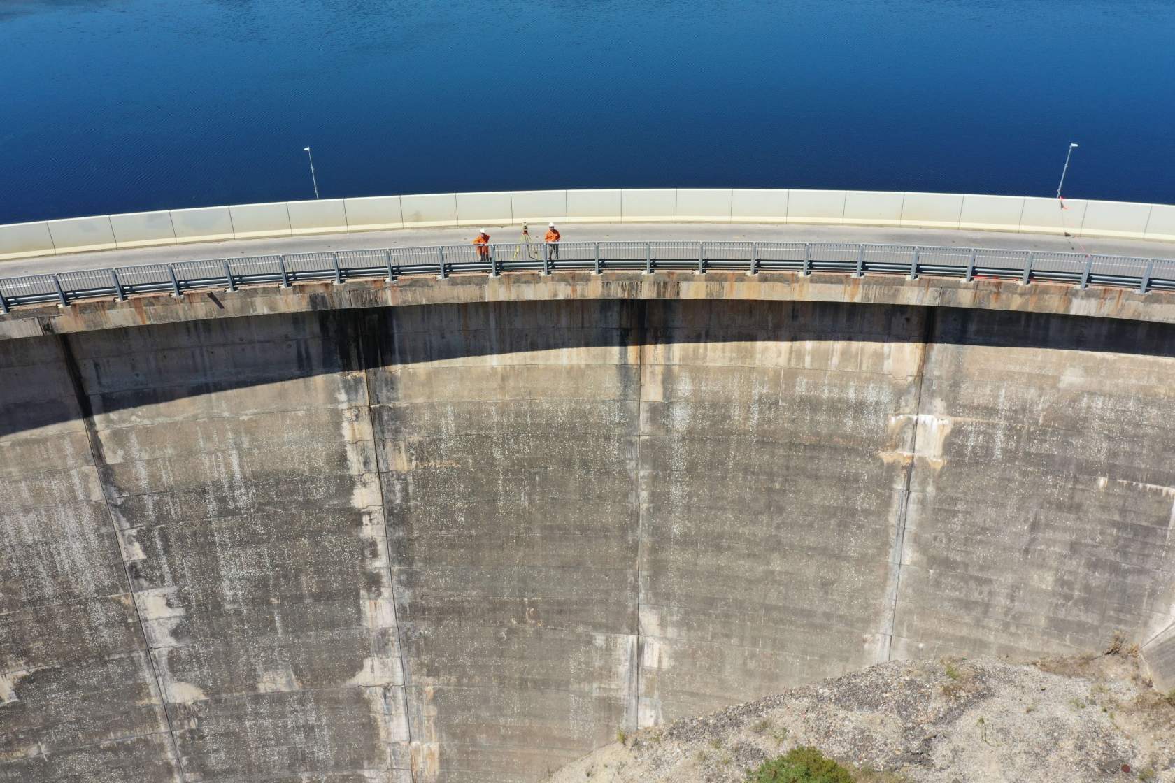
Deformation monitoring
A range of deformation monitoring techniques can be employed to observe the movement or settlement of structures or roads over time, including automated, continuous real-time monitoring and alerts if required.

Verifications and Reporting
Engineering Surveys is a preferred supplier for the Department of Infrastructure and Transport (DIT) and has a comprehensive knowledge of reporting to DIT standards for any construction setout, verifications and engineering survey. Reporting can also be tailored to any required format.