Detail and Topographic Surveys
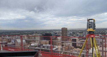
Engineering Surveys' detail surveys division has expanded over the years in response to our surveys being of good quality, real value-for-money and delivered in accessible and client customizable formats. All our surveyors use one-man robotic total stations and GPS units to efficiently deliver accurate pickup of your mapping project.
Detail surveys are processed in the powerful surveying and civil engineering software package 12d Model and plots finalized in Autocad. An emphasis is always placed on clear, very readable and precise drawings with layering in a practical common sense format for ease of comprehension.
We are able to provide:
- Detail and topographic surveys in almost any format including MX Genio files to DPTI standard;
- Comprehensive mapping with contours, spot heights and features;
- Full architectural surveys including location and leveling of all building features
- Pickup and creation of digital terrain models (DTMs)
- Integration with georeferenced 3D point cloud scans if required
- Water-flow diagrams and analysis
- Customized Autocad layering to adhere to quality controls or company standards
- Customized Autocad linetypes with custom shape files if required
- Above and underground services location
- Determination and overlay of title boundary information
- 3D building fascia surveys
- 3D pipe work surveys
