Boundary Surveys and Land Development
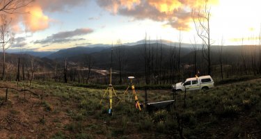
A Boundary or Identification Survey locates where your property boundaries are. This survey provides boundary locations using historical information from the Land Titles Office (LTO) and requires the expertise of the Licensed Surveyor.
Boundary or Identification Surveys are required for the purposes of building or extending a home or commercial development, erecting a fence or shed or to solve a dispute over the location of boundaries. These surveys are essential for peace of mind when building to avoid any risk of expensive problems later.
Land Development
Engineering Surveys licensed surveys division can assist you through the complex processes involved in land development including Residential, Commercial or Industrial property. Whether your project involves Torrens Title, Community Title or high rise Community Strata, Engineering Surveys can provide the professional advice regarding feasibility and assist you from lodgement of the development application to the final issue of titles. Land divisions generally take 6 months or even more but we will explain all the processes and timeframes to ensure your expectations are met. Our fee proposals will provide comprehensive breakdown of all expected costs involved which assist in your financial budgeting. Please contact us for a free no obligation consultation and quotation for your land development proposal.
Other services we can provide are:-
Easement surveys
When a service or rights of access is required over an adjoining parcel of land, a Plan for Easement is lodged at the Lands Titles Office with the necessary documentation from the conveyancer. Services could include stormwater pipes, electricity cables, water pipes or telecommunication cables.
Strata Title amendments
Amendments are required to the old system Strata Plans to enable corrections to the titles such as when new structures are erected, yards are modified or carparks are renumbered.
Amalgamation plans
The joining of two titles into one requires a Plan of Amalgamation. This can be advantageous to reduce rates and taxes but careful consideration of the consequences is advisable. We can advise you and prepare the necessary plans to be lodged at the Lands Title Office.
Boundary re-alignments (Land Division)
To re-align or adjust the boundaries between two properties is considered a Land Division and requires all the same processes and timeframes as dividing a parcel of land into two titles.
Road Closing surveys
Closing a portion of road reserve is a very complex process and can take a considerable amount of time. Once the portion of road is closed it can be amalgamated with your title and enjoy the benefits of the extra land.
Lease areas and plans
When a portion of title is to be leased, it may be necessary to register the lease for protection of your legal interests. A Lease Plan will be required to be lodged at the Lands Titles Office for lease registration purposes. We can also provide lease areas by following the Property Council of Australia guidelines for lease calculations.


